May 27, 2010 Day 37 Driving Out the East Entrance of Yellowstone

Sylvan Pass

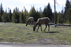
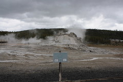
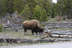
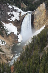
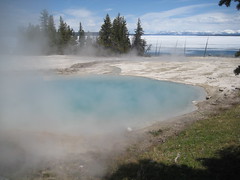
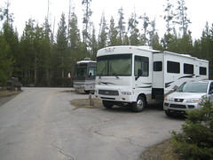
CC went to check us out early from Fishing Bridge so we could be on our way to South Dakota. He came back and we hooked up the car and left out the east entrance to Yellowstone. On the way we passed Steamboat Springs, a frozen Mary Bay, some bison near the fumeroles, an avalanche area near Sylvan Pass with a cool recoilless rifled cannon for shooting snow cornices so they don’t cause avalanches and more bison once we got to the park boundary at Pahaska Teepee. The road wasn’t nearly as bad as people told us it would be. There was only about 20 minutes where the RV felt like it was on the edge of the canyon. At Pahaska Teepee we encounter the never ending road work that goes on in Wyoming in the summer. We were stopped at a bridge construction but it was only for about 3 minutes. The problem was the light would only let 1 car through at a time.

There were unique cliff formations as we drove along. I was able to get many pictures as the speed limit was pretty low in some passes. We neared Cody and went through 3 tunnel passes near the Buffalo Bill dam. We wished we had more time because there was a visitor center there. Everyone always talks about the Buffalo Bill museum which we didn’t have interest in but we would have made time for the dam if we had known it was there. Something for the next trip I guess.

We make a short stop at Walmart in Cody for supplies and gas and get back on the road. The temperature is more like home in FL right now. It was up in the high 80’s. It felt so good after freezing for so long. PTCC even changed into shorts and a T shirt. After stopping in Cody so did CC and I as well.

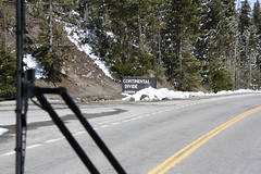
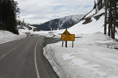
We can see the Big Horn Mountains in the distance and it seems forever to get to them. We go through another rough road with construction between Cody and Greybull. Then we turn south towards Worland and get ready for a climb towards the peak. The actual road was nice with many turnouts to view the North Fork Powder River. The mountains still had a lot of snow on them with the high elevation. We finally came to the top of the road at 9666 elev and passed the Powder river pass in Ten Sleep Canyon. We saw plenty of mule deer and pronghorn deer up in the canyons. No antelope though. Almost as soon as we passed the summit we get stopped by road construction again. This time the flagger was very talkative and told us what was ahead. I guess it gets lonely with vehicles passing you all day long.
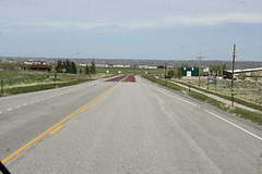
East Side of Powder River Pass

Right as you see the “Welcome to Buffalo, WY” sign the asphalt turns red. I wonder what they have in it that makes that causes that?

Yesterday CC asked what if we pushed on to Devil’s Tower instead of staying in Ten Sleep or Buffalo? I said I was OK with that as long as he wasn’t too tired driving through the passes we had to go through to get there. So we decided if he didn’t feel too bad we would try. So when we got to Buffalo and it was still early enough to make Devil’s Tower, we calledl the KOA there to see if they will have room since we are coming up on a holiday weekend. They say they did, so we reset the GPS to go there. We take the turn off to the tower and you can see it in the distance. It takes about 45 minutes to actually get there though. We pass some steers with huge horns grazing  near the road as we turned onto the park road. We see the KOA ahead and turn in to register. We pick a nice sight and start dinner, eat and then PTCC goes out to the playground to let off some steam. CC and I walk around and take pictures of the grounds and the Devil’s Tower sign as the national park is right next to the KOA. We get PTCC and go across the street for ice cream and just make it before the store closes for the evening. As we talked to the lady working there we asked if some strange weather phenomenon was going on as we had seen these interesting weather trucks from all over passing us today. She told us there was a tornado in Wyoming which hardly ever happens and the trucks had been coming by all day. Several of them went into the park, probably to camp for the night.

Tomorrow we will tour the park and then head for South Dakota.

May 26, 2010 Day 36 Will This be the Day We See the Tetons???

Elk Near Grant Village

Last night was not as cold as the others. In fact there was NO SNOW on the ground or cars. So today we are going to do our best to get to the Tetons. First we are stopping at Fishing Bridge for my park stamps since the visitor center opens today and then we are going up to West Thumb and Grant Village for more park stamps. On the way to Grant Village we see some elk out grazing next to the road. We then get on the road going south and pass another Continental Divide sign elev. 7988. We keep going until we get to Lewis Lake which has a waterfall you can see from the road. So we stop and take photos of it and then continue on to Moose Falls on the Lewis River. This one was very nice because it was a short fall about 30 ft high with the path right next to it leading down. It also had a rock bridge spanning the river. There was a nice path down to the falls, not too hard to walk and not too many steps.

We continue driving and soon come to the park boundary. We were so happy this morning when we called to see if there were any road closures and found out everything except the road construction area was open finally. We get to Flagg Ranch and find out this area will be closed until tomorrow, so we continue on to Colter Bay. We run into the road construction here. They are scrapping the roads and adding new asphalt so we have to wait about 10 minutes. The holds can be up to 30 minutes at a time here. It is a large area they are working on. We notice the temperature is rising as we drop in elevation, it is 52 degrees here. Almost balmy to us. In fact no one wore a jacket all day because we thought it was so warm. We make it out of the mess and get moving to Colter Bay.

We see lots of people stopped up ahead and ask what they are looking at and find out there is a black bear feeding in the woods. So we get out and look. You could see him clearly with the binoculars but not so much with the camera. It looked like he was eating a moose or elk from the size of the carcass. We keep driving and are seeing beautiful views of the Grand Tetons. Today is very nice with clear skies that are bright blue as a backdrop for them.

We stop at the visitor center so PTCC can work on her Jr Ranger badge. They don’t have any ranger programs right now so they give her a scavenger hunt to do in the Indian museum here. And the auditorium doesn’t have the movie right now since they are training their summer hires in there. So we wander around the museum looking at displays and answering questions and she finishes and gets her badge. We look around the gift shop for CC’s pin and a stuffed moose for LCC.

Right after we leave the visitor center we see more cars and the people tell us a moose is in the woods. So we look and right in a stand of aspen trees near the water is a lone moose eating. So we try to get some pictures and then move on. We are now heading towards Moran Junction where the road turns south. We stop at one of the pullouts with the mountain range behind us and get someone to take our family picture.

We tried to see the Cunningham Cabin but there was more construction in the area so we passed it by. We did stop at the Craig Thomas Discovery Visitor Center to look around. It looked like it was just built and very nice inside. It had lines on the floor that you could stand on and look to see which mountain it coordinated with outside the large windows so you knew which one you were taking pictures of. We then left to go up to the Jenny Lake Visitor Center and before we got to it we saw another moose eating near the river. This one we were able to get really good pictures of as well as video. It was only about 20 feet away but on the other side of a sandbar in the river.

After looking around the visitor area and getting our stamps we continued on. The Grand Tetons are so different from Yellowstone because they are so flat on the interior. There are mountains ringing the area but on the inside it is very level with not much change in elevation. So it is easy to see wildlife if it is out here. In the grassy area we saw some pronghorn sheep eating in the fields. We of course stopped to get their picture. I think this is the first sighting we’ve had of them. Meanwhile we are still in awe of the Tetons and are taking lots of pictures of them as well.

We now get moving north as it is getting late so we pass Signal Mountain, but find out the road was closed anyway. We get to Jackson Lake Dam and find out there is construction here too. So we wait awhile till they let us pass. We take some pictures of the work they are doing and some of the dam as well. We get going only to stop in the same place as we did on arriving where they are working on the road. CC gets out to stretch since the signal lady told him it was about 20 minutes to go. He strikes up a conversation with her but I and PTCC just lay on the seats and try to nap. It has been a long day of driving. In Yellowstone you drive about 20 minutes and then get out to view something or walk a trail. Here in Grand Tetons there is much more driving and not as much to see or do right now because of the season. Also there is a lot more road work going on with longer waits.

Finally we are allowed to precede and we are now heading back to Yellowstone. As we climb it starts getting colder again. Our high in the Tetons was 62 degrees, when we got back the car read 53 degrees. This was our longest day out yet. We left this morning at 9 am and didn’t get back until 5:30 pm. We usually stop by 3 pm but didn’t have a choice today since we decided to leave early tomorrow so we will have more time in South Dakota.

May 25, 2010 Day 35 We Think We’re Going to the Tetons

Motorhome_car_with_snow

We get up and find out it has snowed all night. It is 30 degrees outside and still snowing. The car is covered and so is everything else. It is melting off the roads so we are hopeful that the roads aren’t closed where we want to go today. We’re going to try to make it to the Tetons which are south of where we are but we need to climb in elevation because we will go over the Continental Divide once more at 7988 ft. So we get everything together and jump in the car. We stop at the camp office to check the roads and the workers tell CC that the roads are open except Dunraven Pass which has been closed since we got here. We then head south passing through Lake Village, Bridge Bay and West Thumb. The plan goes awry when we get to Grant Village and see flashing signs and the barricades up across the road. So we pull in to the gas station in Grant Village and ask about the conditions there. The clerk said anywhere from 30 minutes to 2 hours since they were sanding the road. So we decide to do plan B which was to do the lower circle and concentrate on what we haven’t seen yet. So we head back to Old Faithful area to do the Upper Geyser Basin area. We passed a few elk on the sides of the road on the way but didn’t see any other wildlife out yet. Probably just too cold for them. We pass the Continental Divide twice again and stop to view the Kepler Cascades before arriving at Old Faithful. It was scheduled to go off at 12:17 pm, but I think we will miss it because we will be on the boardwalk 1.5 miles north.
Geyser Trail in Old Faithful Basin
We get on the boardwalk and head to the Castle Geyser which is quite tall. It was steaming but not scheduled to go off until late afternoon. There were quite a few bison roaming around the area. The best geyser to view was the Spasmodic Geyser because it was so erratic with its bubbling and spewing. The most colorful was the Chromatic Pool which had all the colors we’ve seen in the geysers all together. I took a video of PTCC in front of the Grotto Geyser in which she leaned backward and looked liked she was spitting water with the geyser shooting up behind her. We then took another look at the stores and bought my stuffed bison but we can’t find a name for it yet. We saw Canada Geese on the lawn of the Old Faithful Inn and took their photo. We got back to the car and ate our lunch then went on towards Norris. On the way we saw a mother bison with her calf next to the Firehole River. The park ranger was waving away the tourists because they were getting too close to them. We saw a few more elk near the river as well. Photos from the Old Faithful area are here.

Bison on roadside

We get to Madison and know there is construction ahead between Madison and Norris. They are building a new overpass on the Gibbon River. So traffic will be stopped at times up to 30 minutes. We are so lucky though because we come upon the work and get there as they are letting the cars go. Because of the work this means we won’t get to see Gibbons Falls which is one of the tallest in the park since that is where the work is taking place on the road. We do get to stop at the Artist Paintpots but I think we were all a little disappointed here. We thought we would see very colorful geysers and paintpots but they were rather bland. The walk is was nice though. It felt almost like walking through a Christmas forest with all the pine trees on the path and you could smell the pine scent in the air. We did see an interesting sight there though. There was a pine tree that was all twisted like a candy cane looks. Don’t know how it happened, maybe the wind pushed it and twisted it as it grew.

Lower Falls from Lookout Point

From Norris to Canyon we did not stop because there was nothing that we hadn’t already seen. So we get to Canyon and take the Brink of the Lower Falls road to check out what we could see there. There were some spectacular views of the Lower Falls from this area. We then took the North Rim drive to see more of the Lower Falls. The Fall has a green streak in it which is very unique. We then drive to Lookout Point and Grand View to take more pictures. All of our pictures are beautiful of the Lower Falls. Then we drive to Inspiration Point and see a huge Glacial Boulder and then walk down the steps at Inspiration Point for more photo ops. The Grand Canyon of Yellowstone walls were gorgeous in the light. It looked like an artist had painted some beautiful watercolors of oranges, reds, pinks and greens with a lot of yellow added in.

We then drive back to the Brink of the Upper Falls to see what it has to offer. We stop and take lots of photos here as well. There was still much snow on the canyon walls and it was very cold here as well. We drove all the way to the end of the road at Artist Point and walked the overlooks here. A nice young lady offered to take our family picture for us with the waterfall as a back drop. We tried to see Uncle Tom’s Trail but there was a medical emergency and the park rangers had closed off the parking lot to bring a helicopter in to airlift the person out. He said they were hurt in the back country. So unless we have some extra time we won’t be able to get back to this area again.

So now that we’ve seen the loop we head back to Fishing Bridge and on the way we see lots of cars stopped ahead and look at what is on the top of a rise. A coyote is up there alone and is scoping out the area. He is probably hoping to jump on a baby bison if the mom is not paying enough attention. We get some good shots of it running along the ridge and then it disappears just like we do when we continue back to the RV.

We get back and turn on the generators and throw all our stuff inside and then head out to the Fishing Bridge store and diner. We are going to eat out tonight and then shop and walk on the old Fishing Bridge and look around. After we eat PTCC wants a jacket like CC and I have from Yosemite but instead says Yellowstone. We have seen many people in these since they probably didn’t expect it to be so cold here and had to buy a jacket once they got here. She also wants some T shirts and I will get another Yellowstone frame. CC just buys milk for breakfast. He already got a shirt earlier at Old Faithful and I guess we do need the milk. We then go walk on the bridge and see the ice flows in the Yellowstone River and take some pictures of the mountains in the distance. It has gotten warmer and is a comfortable 43 degrees outside now. Probably I think because the sun has finally come out of hiding. We walk back along the opposite side and get back in the car to head to the campsite for the night. I think I will call it a day now, it has been a long one. Hopefully we will get to see the Tetons tomorrow.

May 24, 2010 Day 34 Heading North to Mammoth


We were so cold last night. It was 47 degrees inside the RV and 33 outside when we got up this morning. PTCC jumped in bed with us and snuggled until 7 am. We got up and ate breakfast in the cold with the gas heat going until 8 am when we turned on the generator for 30 minutes before we left to head north. We had to brush the snow off the car because it had 1.5 inches on it. The road to the south entrance was closed today because of too much snow.

We head out towards Canyon Village and of course see bison grazing in the valleys, we also see another headed up the side of the road again. I wonder if it is the same one from yesterday? We stop in Canyon for a second to use restrooms and take a quick look in the visitor center but we don’t stay long because we will stop on the way back. Our idea is to go to the north entrance and turn around and come back and do do most of our stops then. We continue on to Norris and take a right to go north. We do stop at a pull out to take a picture of Roaring Mountain which is covered in snow. Good thing I put snow boots in the car for PTCC and me. We then drive until we come to Sheepeater Cliff where the Shoshone Indians lived. It is all basalt lava that looks stacked in columns and marmots are said to live in the joints. We weren’t lucky enough to see any of them. We continue on past Golden Gate where we ended up driving through the clouds where it was very hard to see anything. We finally get it to Mammoth Hot Springs. PTCC spied some mule deer on the side of the mountain so we once again stopped to take pictures and where we pulled off was the horse ranch near Mammoth. Good thing we saw it because we were going to try to ride horses here too but the ranch is closed to rides right now. The Yellowstone newspaper said it was open so that saves a drive back up here later. Then we looked around and saw part of the Mammoth Hot Springs Terraces. It was the upper part and very beautiful with all the different colors mixed together.

We drive through Mammoth and see the Mammoth Hotel and one of the Yellow Tour buses in the parking lot. On the road outside of town we pass a wooden sign that said entering Montana. We come to the exit of the park and go through the entrance arch and are now in the town of Gardiner, MT. We park and walk back to the arch to take our pictures. Then get back in the car and go back into the park through the north entrance. The entrance station is not as nice as the one in West Yellowstone even though it is the only one open all year long. We come to another sign that advertises the 45th parallel. This is the halfway point between the north pole and the equator. We then see the sign that says entering Wyoming, which is on the back side of the entering Montana sign. We make it back to Mammoth and stop at the visitors center and look around. It seems really small compared to the others in the park but it is in an original building from 1909. Most of Mammoth is part of Fort Yellowstone when the army ran the park until the National Park service was formed. There are lots of historic buildings in the town. We then head over to the lower terraces of Mammoth Hot Springs to look at the geysers there. This area is one of the world’s best examples of travertine -depositing hot springs. The features here are changing constantly so every time you see them they will look different from the last time. The Minerva Terrace looked like huge blocks of ice stacked on top of each other in a staggered array. No water was running down them at the time. The Palette Spring looked active and we also took pictures of the Liberty Cap with looks like a large African anthill. We then walked on another boardwalk to get to the front of the Palette Spring to see the water cascading down it creating awesome colors. The travertine pools in the Main Terrace looked as smooth as glass with steps coming down.

We ate lunch and warmed up then drove up to the Upper Terrace area. This is on a one way road that is very narrow so no RVs or buses can drive on it because of the way it twists back and forth. We stopped and took photos of the Orange Spring Mound, which was as the names implies bright orange. It actually had water seeping down it. Then we went to see White Elephant Back Terrace which did look like the back end of an elephant lying down. Then on to Angel Terrace which wasn’t as impressive since the water wasn’t flowing down it.

Then we get back on the road and drive until we see a side road that leads into a miniature canyon across from the Hoodoos. They are huge boulders made from travertine that look kind of spooky to people. The fog has become so thick it is very hard to see beyond the road. We have 3 NP rangers pass us with their lights and sirens on in this area so it’s possible there was an accident in the fog. We head back to the Golden Gate, so called because of the color of the rocks. It is a bridge that pretty much hangs suspended from the cliff. You do not realize it unless you are traveling northbound since you can’t see the structure from the southbound road. Here is also where we found Rustic Falls. They are about 40 feet high and if you don’t look for them you will miss them because they are not marked by any signs.

As we come to Norris we decide we are still good on time so we will stop at the Geyser Basin here for a walk around. They seem to be pretty active with some beautiful blue pools of water. There are also some bacteria pools which make the water green. So we walk the boardwalk area through the Porcelain Basin to view all the geysers. We were able to see 2 actually in action. The colors come from chlorophyll(green), sulfur(yellow), iron(dark brown and red), and algae(dark blackish green). Some of these get up to 200 degrees F.

Then we headed up the road to the Canyon Visitors Center to look more in depth at their displays. We hammed around with the bison display acting like PTCC was petting and kissing the baby bison, and I was kissing the back end of the adult bison. It looks really funny in the picture. CC didn’t want a picture of him with the bison, I don’t know why? We looked at their volcano and caldera information and then want to the bookstore. We were stopping by the sporting goods store there as well because on my hike around the Lower Geyser Basin at Mammoth I discovered my hiking shoes soles were peeling apart so I was looking for new shoes. As it turned out they had 2 types that fit and were a good price so I was able to replace the old ones today. It was not so fun walking everywhere in my snow boots but I was lucky I had them in the car with me. At the store CC was able to get a photo of a tiny chipmunk that was hanging around the trash can area. It looked like it could fit in your hand. Hopefully PTCC doesn’t see the pictures or she will want one as a pet. The last thing we did today was stop at the Fishing Bridge visitor center. It isn’t open yet but the view of the mountains and lake behind it were beautiful at the end of the day so we had to get a photo of them. Then back to the RV to charge the batteries and warm it up for tonight. Early dinner and another early night. Tomorrow we will try to see Grand Tetons if the road is open. PS It is starting to snow again. When will it ever end?

May 23, 2010 Day 33 Yellowstone Here We Come


We get up to find out it snowed about ½ an inch last night. The RV is covered in snow as well as the car and campsite. It is 32 degrees outside. CC goes out to hook up the water so we can get breakfast and brush our teeth. Then we pull in the slides, hook up the car and away we go to the Yellowstone Visitor Center. Before we left we did check with Grizzly RV to find out if they had openings in case the roads closed down on us and they did so we have a backup plan if needed. At the Visitor Center we get PTCC her Jr Ranger book and recheck the conditions. The last update was at 1235 am and the only thing closed is Dunraven Pass because of the high elevation. So we get back in the RV and head out. We show my pass at the entrance station and we’re now in Yellowstone. The roads look clear with no snow on them, which is good. We are riding alongside the Madison River and not too far down the road we see a bison family. 2 adults and a calf are walking alongside the road. We of course take pictures and move on since they weren’t blocking the road. Still following the river we see some Trumpeter Swans floating along. Then we take the turnoff for Firehole Canyon Drive which runs next to the Firehole River and has a waterfall. We take lots of pictures and videos and get someone to take our picture by the sign here. We are going in the direction of the Midway Geyser Basin when PTCC yells bison! There is a large bison walking down the center line of the road so we give him room to walk and wait for him to go by. In one of the pull outs I snap a picture of a Bald Eagle high in a tree next to the road. Our next stop is at Nez Perce Creek where we stop and read the information sign about Chief Joseph trying to keep his tribe off the reservation. Then we come to the Fountain Paint Pot area and stop there to walk around the mud pots. The ground is all white from the minerals spewing up and it smells like sulfur. We see a lone bison right next to the boardwalk grazing. They look so bad this time of year since they are molting their thick coats. They should probably keep them a little longer since it is still snowing this week. We walk around and see the Clepsydra Geyser and Spasm Geyser which have lots of steam around them. All the tree branches are bleached white from the minerals in the water.

Then we make our way to the Midway Geyser basin where we walk over a bridge on the Firehole River. We could see streams of water running into the river from the geysers and wherever they fell in the river plumes of steam came up since the river is so cold right now. The streams were amazing colors of orange, rust , red, and browns. The steam was so thick we couldn’t see where we were going sometimes. The pools were the most beautiful aquamarine blue I’ve ever seen. It was hard to get good pictures because of the amount of steam coming from them. We walked the boardwalk until we got to the Grand Prismatic Spring. This is the one that has the most colorful pictures taken of it. It’s hard to see unless you are above it. There are these really bright orange bacteria mats that we walked over. At the end of the boardwalk was this little conifer tree that had icicles all over it so we snapped a shot of it. As we drive on towards Old Faithful we see several herds of bison with the calves and mothers near the river. There was also a lone bison across the river-I guess he didn’t want to be crowded.

We make it to the Old Faithful visitor center and park the RV and go inside. PTCC has already finished her Jr Ranger worksheet and can be awarded her patch. CC gets his pin and I get my NP stamp. Then we head outside to look around since Old Faithful will blow sometime near 1217 pm. We get our picture taken at the Old Faithful sign and then walk over to the Old Faithful Lodge and walk around inside and check out the shop. They have a cafeteria inside as well. We head back to the viewing area and take seats in the front row to wait for the show. We work on the pages of PTCC’s Jr Ranger book that she didn’t have to do before. We wait around and at 1219 pm Old Faithful starts to blow.(PTCC here- It started with 2 false alarms, and when it actually went off at first it was like “This is worse than the ones at Disney” but after it got a good start I was actually like “WHOA THIS IS AWESOME” and that was an awesome experience totally epic). After the show we walked around the geyser basin. The bridge to the upper area was closed because an elk had been killed near the upper side of the river and the rangers didn’t want people near where a bear or wolf might show up. We were able to see Castle Geyser and the Beehive Geyser before moving on to the Old Faithful Inn. We purchased our Yellowstone picture frame here and took pictures inside the building and then headed back to the RV for lunch.

After leaving the Old Faithful area we cross the Continental Divide (elev 8262 ft) at Craig Pass and again a few minutes later (elev 8391 ft). Then we see the West Thumb of Yellowstone Lake. It is huge and covered with ice. We see elk on the left side of the road but can’t stop because there is no room left in the pull out. We then drive on to the West Thumb Geyser Basin and stop to walk around the boardwalk here. It flanks Lake Yellowstone and the geysers are all pure topaz blue in color. There were ducks out swimming in a little patch of water in the frozen lake. The Grand Tetons could been seen in the background. The pools looked just like some of the springs we have in FL such a deep blue in color. One of the signs I saw said the water was 167 degrees. Not a good idea to jump in.

We continue driving and see the Arnica Creek Sandbar that was the original road that stagecoaches used to get around Yellowstone. We pass Bridge Bay and the fishing traps that Indians added to the lake to catch fish. We then pass Lake Hotel and the next stop is Fishing Bridge. We roll over this old wooden bridge with pedestrian walkways on each side and come to a small village that has a gas station, shop, visitor center, mechanic area, and a warming hut for cross country skiers. And then we finally see the sign to check in for Fishing Bridge camping. Yeah we are here. We check in and go to our site. We are in the last section because we want to use our generator. We have sewer and water but no power. A lady in a shop later told us that Xanterra is 2 years away from the end of their contract and they don’t want to make expensive changes unless the NP renew the contract so they are waiting to see what happens. The power fluctuates so much because of the larger coaches taking 50 amps when the park was only built for 20/20 amps years ago. It caused so many meltdowns and brownouts that they are not offering power anymore.

PTCC sees snow piled up in the woods so the first thing she wants to do is play in it. So she grabs her bibs and snow boots and away she goes. She works on building a petite snow woman that is really cute. After we get set up we head back up to the village to check it out in the car. The shop has a grocery, a dining counter and a huge array of goods for us tourists. CC talked to a saleswoman that was from AZ and got the low down on stuff in the area and I met a woman that lives around the corner from us in FL. Literally ¼ mile from our house. She and her husband came out last year and liked it so much they decided to work here this summer. They will stay until mid September and then head back to FL. After checking everything out we came back to run the generator to charge all our electronics and make dinner since we won’t have power after 8 pm. It’s been a busy day so I’m sure we will all sleep well tonight.

Leg 6 – Part II – West Yellowstone to Fishing Bridge

Snow on picnic table
Up early, and there is snow everywhere. I really don’t want to drive the RV in snow. I call the Yellowstone road conditions number and they say that the roads that we want are open, but the road from Old Faithful to West Thumb, which crosses the Continental Divide twice, is “snow tires recommended” and “snow packed.” Oh boy. I start the day off by trying to talk Lady CurbCrusher into staying in West Yellowstone and driving into the park for a couple of days. That just puts a damper on the start of the day for everyone, because, as you all know “if Momma ain’t happy, no one’s happy.”

So we drive the short distance to the entrance to Yellowstone National Park. Except for the cold, the driving is not bad. We’ve decided that we’re going take the southern route from Madison to Old Faithful to West Thumb, then up to Fishing Bridge, and that we’re going to stop and see the stuff along the way in the RV as we make the trip. The total distance is about 60 miles, but we take about six hours to make the trip, stopping at most of the sights along the way. This is a bit of a pain, because the motorhome/car combo does not fit in a lot of the “RV” parking spots that are in the various pull outs in Yellowstone.

Craig_Pass_Continental_Divide
We reach Craig’s pass (the Continental Divide) area in the afternoon after lunch. It is fine. The weather forecasters have been wrong, and instead of overcast skies, there has been sun for most of the morning. So the road is dry, there is snow on either side of the road above about 7500 feet, but the driving is safe. The worse part is the climbing, but our trusty Workhorse and Allison combo keep up with the speed limit on the climbs with no problem.

West Thumb Geyser Basin Trail
This is the deepest into the park that we’ve ever been, as Lady CurbCrusher and I had made a winter visit to the park about 13 years ago and been as far as Old Faithful. At West Thumb, there is another geyser basin, and I think it is more impressive than the ones around Old Faithful. This geyser basin sits on the shore of Lake Yellowstone, which is still frozen, except for the area along the shore where the hot water from the geyser basin empties into the lake. Very cool, and very picturesque with the mountains across the lake.

The final part of the trip is from West Thumb to Fishing Bridge. This is about a 21 mile road that runs along Lake Yellowstone. The road is an easy drive, and you get great views of the lake and mountains all along the road.

Campground_road_and_site_321
Fishing Bridge has the only “full” hook-up RV park in Yellowstone National Park. However, there is not electricity. A lady up a the store told us it was because Xanterra, the company that operates the shopping and campground concession, only has two years left on their contract, and does not want to spend the money upgrading the electric capabilities in the park unless their contract is renewed. Regardless, it means that you get water and sewer and and electric box that you can not plug into. The sites are tight, with enough room for your rig, and a place to park your car next to it. While the place was probably designed and built when a big RV was 25 foot, there are a number of “big” rigs (35ft + ) in area we are camped in. However, since there are not a lot of folks there, they are only using one side of each loop. That makes it feel a bit more roomy, and they are trying leave every other site empty to give the feeling of a larger site. As there is no electricity, and generators are permitted from 8 to 8 each day.

Leg 6 – Salt Lake City to Yellowstone.

First things, we have a reader. Yay! There are very few comments left on the blog, so we often wander if anyone is reading the darn thing. But yesterday we actually got a comment, so thanks.

On the road again, yes we are. After a two week stop in Salt Lake City so that Mr. CurbCrusher could go home and earn some gas money, we headed from SLC up to West Yellowstone, MT. West Yellowstone is located right outside Yellowstone National Park, and is our stop over before venturing the last 60 miles or so to Fishing Bridge campground located inside the park.

The trip was about a 330 mile trip, and was fairly easy driving for most of the day. We started by stopping by a Walmart in Layton, UT to fill up on groceries and try and get the oil changed in the motorhome. We got the groceries, but they did not have the right oil filter, so we’re still running old oil.

We headed up I-15, exited Utah and entered Idaho. As we approached Pocatello, it got a bit snowy. The outside temperature dropped to about 34 and we were driving in the white stuff. This continued for about thirty or forty miles. Little CurbCrusher was fascinated looking at the snow building up on either side of the wipers, and sat in the front seat watching the ice build up and then fall off the windshield. At Idaho Falls, we broke off the interstate, and took US-20 north to West Yellowstone. The last pass before West Yellowstone, Targhee Pass at 7072 feet, was full of snow also. The west side of the pass, there was no snow sticking, and the road was just wet, but on the east side of the pass, the snow was sticking to the road. Cars and trucks were making tracks through the snow. As we came off the pass, there was an upside down Explorer on the westbound side of the road, with a number of people stopped. As we headed further east, we were passed by rescue vehicles responding to the accident.

The driving was surprisingly easy, even with the weather. We just took it easy on the climbs, and the there weren’t really any downhills. I think we are continually climbing up, as Fishing Bridge I believe is another 1000 feet above where we are now. I don’t think we get the challenging downhills until we exit Yellowstone to the east towards Cody. For now, with the current weather forecast, I think just driving to Fishing Bridge is going to be challenging enough, as will trying to drive around and visit stuff in the park if the silly snow keeps on coming down.

We are now camped at the Grizzly RV Park. It is a very nice park with good sized pull-thrus and full hookups. However, we have to disconnect the water at night because of the cold temperatures. A lot of people camp here, and the drive into Yellowstone each day. We’ve decided that we want to be at Fishing Bridge, which is smack in the middle of Yellowstone. That will reduce the driving, but I can see how staying at the Grizzly is attractive. In addition to full hook up, there is cable, and the town of West Yellowstone provides you with a nice place to walk around and visit shop, eat and pass the time. Given my druthers, I think I might would stay here and trek in to the park each day.

May 22, 2010 Day 32 We’re On Our Way Again

CC and I get up early and have breakfast and finish up the preparation for leaving. We are going to stop at the Flying J for more propane and then drive to the Walmart in Layton for an oil change. It is 39 degrees outside. It rained all night and snowed in the mountains. You can’t see the tops of them because the fog/cloud cover is so thick. It will not be a sunny day for a drive, that’s for sure.

We have no problem at the Flying J getting the propane so we mosey on to I-15 to go to Walmart. We get there and park and then go in to tell them we called about an oil change. They had to roll the doors all the way up to get us inside. We go to do our shopping and return to find out that they couldn’t do the oil change after all. They did not have the filter necessary for our RV. So all we can do is hookup and leave after loading our groceries. CC also bought a pool noodle hoping that it will help insulate our water line in Yellowstone at Fishing Bridge.

We get on our way and it does look ugly ahead of us. There are very dark clouds hanging over the mountains and the road is still wet from the rain, but at least it is not raining right now. We make it into Idaho and they actually do have a visitor center in this state. But we pass it up because we have just started on journey. About 20 miles into Idaho we hit sleet. Not what we want to see right now. It is piling up on the front window. PTCC wants to sit in the front so she can see it. It piles up so much from the wipers pushing it and then it falls off the windshield. CC told me it is 36 degrees outside. Yuck.

We go for another hour and then stop at a rest stop to have lunch.

All through Idaho we encounter snow showers and they continue into Montana. Even with them we are making good time so we should be in West Yellowstone around 3 pm.

We are in West Yellowstone now. We gassed up before finding the RV Park. CC had a surveyor ask him a lot of questions while he was gassing up the RV. All about what we planned to do while in town and how long we will be staying. After he is through we head to Yellowstone Grizzly RV and check in. It looks like a nice park with lots of green space. Our site is directly across from the playground like we asked for so PTCC could play if she wants. It is still snowing though so I think it is a little too cold to hang around outside. We set up and then head into town to get gas for the car. It is hard to fuel both the car and RV at the same time because the car has the gas fill on the passengers side which makes it hard to reach with the gas hose. So we check out the town while driving around. We stop at the Bear and Wolf Discovery Center and look through a few gift shops. We then decide we are hungry and eat at a Mexican restaurant. Then we find the Visitors Center that also has a National Park desk for info. The gentleman there said we could pick up PTCC’s Jr Ranger book in the morning before heading into the park. We asked about road closures since it’s been snowing and he gave us a number to call in the morning for the latest closures. We then went to get our gas and come back to the RV park. On the way we saw a bison grazing in town. That makes 2 animal sightings today. I saw a moose eating a tree in the Targhee Forest on the way in but could not get a good picture because of our speed and the snow. Hopefully tomorrow we will see many animals and lots of geysers on our way to our campsite. We finally got our Mi-Fi working so as long as we have Verizon hopefully I will be able to post.

May 21, 2010 Day 31 CurbCrusher Comes Back

Today is the day that CC comes back to SLC. I check his flight data when I get up and see that his plane left on time to Denver. He said he would call when he gets in there. PTCC sleeps until 9:15 am and then gets up to have breakfast. We finish up some last minute clean up stuff and around 10:45 am CC calls to tell us that he made it to Denver. His plane will land in SLC around 1 pm. We make plans on where to meet and then hang up. PTCC starts working on finishing up her 1st semester module in Spanish. She takes her mid term and now has only a collaboration to do. She posts that and needs to wait for someone to answer her and then she will be finished. I do some more research on Yellowstone but the wi-fi is acting up again. This has been a nice RV park except for 2 things: how close the RV’s are parked to each other and the crazy wi-fi. It seems to work fine either real late or real early but is very iffy in between.

CC has called to tell us to pick him up and we head to the airport. They only have 2 terminals in SLC so it is very easy to navigate. We get him and make him drive us back to the park. PTCC is already jumping up and down and wanting to swim. So after a quick lunch we all head out to the pool. CC and PTCC jump right in and CC finds out he needs to stay in the deep end because if you pop your head up it is cold outside. The pool temperature is about 90 degrees but the outside air is only in the low 60’s. They play for awhile and then I leave to go back and take a nap. I’m glad PTCC finally has her dad to play with her in the pool. I know it was getting boring being in it by herself.

The weather is going to get worse soon so when they come back we start racking the bikes and picking up the inside so we can go early in the morning. PTCC helps CC make dinner and then we watch some TV and CC goes to bed. He is still on East coast time.I’m so glad we’re going to move tomorrow. SLC is nice but too cold for me, but I know Yellowstone will be colder.

May 20, 2010 Day 30 We Clean Up

Today is the day to clean the RV thoroughly before we begin the 2nd half of our trip. PTCC slept until 9:15 am this morning, so we waited until breakfast was finished then got to work. I got to work vacuuming and she got to Windex everything in sight. After changing sheets and towels and cleaning the bath and kitchen. We head to the office so PTCC can work on her WebKinz video that she is creating. Then she swims for awhile. I think she will miss this nice warm pool when we hit Yellowstone this weekend. The weather will be ugly, they are expecting snow showers almost everyday while we will be there.

I really wanted to see Yellowstone in the spring, we have been there before in the winter before PTCC was born.

When watching the news tonight I saw where a girl had fallen off the trail at Timpanagos Cave yesterday (she’s in serious condition) and a ranger was killed today when he slipped off the trail while riding his scooter to the top. It seems we have been there just hours before a lot of news this week. The same day we went to Antelope Island State park several bison were released there because they could not make it to Idaho because of the snow. I’m wondering if those were the ones we saw because when I talked to the people from Panama City they said they did not see any wildlife when they visited. We have traveled through several areas that later that day or the next were on the news. When we went to This Is The Place, the March of Dimes were having a walk that day that was later on the news. Luckily for us we were off I-15 before a huge accident took place where a mid size car ended up under an 18 wheeler when the FedEx driver was cut off and another truck hit the FedEx truck and tipped over. I hope it stays like this for our future travels, I know we don’t need any problems.

The rest of the day was uneventful for us and we finished up the laundry and had dinner, then settled in for the night. CC will be here tomorrow so we will all be together again.